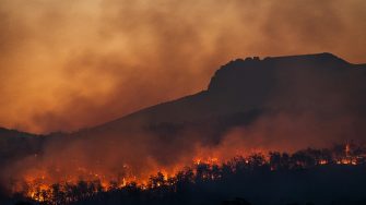
Ask an Expert: How Foehn winds exacerbate bushfires
UNSW Canberra experts shed light on weather phenomenon that can make bushfires drastically worse.
UNSW Canberra experts shed light on weather phenomenon that can make bushfires drastically worse.

The world’s weather is increasingly becoming more volatile and difficult to predict with the effects of climate change.
In Australia, extreme weather events are increasing in frequency, and weather conducive to extreme bushfires is predicted to occur more often in the years and decades ahead. This has been clearly evident in the destructive bushfires burning across large parts of Victoria.
At UNSW Canberra, our academics are committed to deepening our understanding of the factors, like weather, that drive extreme bushfires. One such factor is Foehn winds, a phenomenon that has previously exacerbated bushfires across the country and in other parts of the world.
UNSW Bushfire director Professor Jason Sharples and Dr Wenyuan Ma have studied the changing occurrence of Foehn winds and their effect on bushfires in the hope of improving bushfire predictions and educating firefighters on how to respond to them.
Foehn winds are warm, dry, and strong winds that blow down the leeward side of a mountain or significant topography.
Imagine moist air trying to climb over a big mountain. On the way up it cools down and the moisture in it turns into clouds and rain – which is why the windward side of the mountain is often wet. After moving over the ridge, the air slides down the other side, gets squashed by higher pressure, and warms up quickly. Because it has already lost most of its moisture, the air on this side is now much warmer and drier. That warm dry wind is what we call a Foehn wind.
But Foehn winds can form another way. Sometimes the heavy, wet air never makes it over the mountain at all - it gets stuck on the windward side. Instead, a layer of potentially warmer and drier air sitting higher up in the atmosphere is able to pass over the mountain. This air moves over the mountain, rushes down the far side, gets squeezed by pressure, warms up quickly, and shows up warmer and drier. Different route, same ending: Foehn winds.
The presence of clouds on the windward side of a mountain and clear skies on the leeward side is a good indicator of Foehn winds.
On the windward side, cloud cover often builds up as moist air is lifted and cooled. If you see thick clouds (and rain), it might be a sign that the Foehn process is happening and the air is losing moisture. But in some cases, even without strong windward clouds, Foehn winds can form if drier air from higher altitudes skips over the mountain and descends.
On the leeward side, two characteristic features may be observed. After the air descends and warms, clouds usually disappear, leaving clear skies near the mountains in a zone known as the Foehn Gap. High above and further from the leeward side, a striking arch-shaped cloud band — a Foehn Arch — can often be seen. It forms as moist air at higher levels condenses into cloud, while the lower levels remain clear due to warming and drying during descent. The Foehn Arch has a sharp upwind edge and can extend hundreds of kilometres downwind.
Foehn winds can have a huge impact on bushfires because they are warm, dry, and strong downslope winds — basically the perfect recipe for trouble.
First, they act like a giant hairdryer aimed at the forest: the warm, dry air sucks the moisture out of leaves and branches, leaving the fuels drier and ready to burn. Then, once a fire starts, the strong winds behave like a set of giant bellows, fanning the flames, pushing the fire front forward, and even tossing embers far ahead to ignite new spot fires. Even worse, Foehn winds can arrive suddenly, like an uninvited guest, triggering sudden increases in fire intensity and spread. All of this makes bushfires more difficult to predict and much harder to control.
For example, in California, many major wildfires are associated with Foehn winds. In 2003 and 2007, wildfires in Southern California, driven by Foehn winds exceeding 150 km/h, destroyed thousands of homes and caused billions of dollars’ worth of damage. The Santa Ana winds, which drove the disastrous 2025 Los Angeles fires (in winter) are an example of a Foehn wind. Similarly, studies in New Zealand have shown that the most common severe fire weather conditions occur to the east of the mountain ranges of both the North and South Islands and are associated with north-westerly Foehn winds.
In Australia, Foehn winds most commonly occur along the southeastern mountain ranges, particularly over the Great Dividing Range in New South Wales and Victoria. When westerly or north-westerly winds cross the ranges, they bring sudden temperature rises, sharp drops in humidity, and gusty downslope winds that often affect the coastal plains and lowlands to the east. The southeastern lowlands of Tasmania are also prone to Foehn winds, where frequent north westerlies bring dangerous fire weather conditions.
Foehn winds in Australia can occur at any time of year, but they are most common and most significant during autumn, winter and spring when westerly and north-westerly synoptic flows dominate over southeastern Australia. These seasons are characterised by the frequent passage of cold fronts and low-pressure systems, which force moist air across the Great Dividing Range, creating the conditions for Foehn events.